Laser scanning and as-built services.
Digital twins, reality capture, and point cloud conversion into Revit-ready as-builts and 2D CAD outputs. Servicing building owners, architects, contractors, developers, and asset managers — nationwide.
Two services. Delivered nationwide.
Survey-grade 3D laser scanning and Revit-ready point cloud modeling — the foundation for scan to BIM, digital twins, as-built drawings, and as-built data. Both delivered against defined tolerances and a clearly defined scope.
Survey-grade scanning, delivered nationwide.
Scans are captured with survey-grade equipment across any US metro, then registered into a point cloud ready for modeling. Occupied sites handled with phased and after-hours capture.
- Leica RTC360 · BLK360 G2
- Trimble X12
- FARO Focus Premium
- NavVis VLX mobile SLAM
- Matterport Pro
Point cloud to Revit, delivered not promised.
We convert raw point clouds into Revit-ready 3D models and 2D CAD drawings. QA-validated against the scan, ready for your design team, BIM coordination, and clash detection.
- 3D — Revit-native parametric models
- 2D — Plans, sections, elevations, RCPs
- Ready — Coordination-ready for Navisworks
100+ buildings, captured as-built.
Reality capture projects across the country — offices, healthcare, industrial, hospitality, and historic work.
Scan. Process. Modeling.
Three gated steps. Each has a deliverable, a QA checkpoint, and a sign-off before the next begins.
- 01
Scan
Survey-grade laser scanning on site — Leica, Trimble, FARO, and NavVis equipment across any US metro. Multiple setups eliminate shadows and achieve full coverage, with phased and after-hours capture for occupied buildings.
±6mm accuracy onwardsAny US metroOccupied-site phasingExplore laser scanning - 02
Process
Cloud-to-cloud registration, colorization, and decimation. Setup error is verified against your project tolerance — registered clouds are delivered at ±6mm accuracy onwards — then indexed for modeling.
±6mm C2C onwardsColorized + decimatedTolerance-verifiedSee what we register - 03
Modeling
Revit authoring at your specified level of detail — architectural, structural, and MEP traced from the indexed point cloud, dimensionally verified against it, and delivered ready for coordination.
LOD 200 standardLOD 350 on requestRVT · IFC · DWG · PDFExplore point cloud modeling
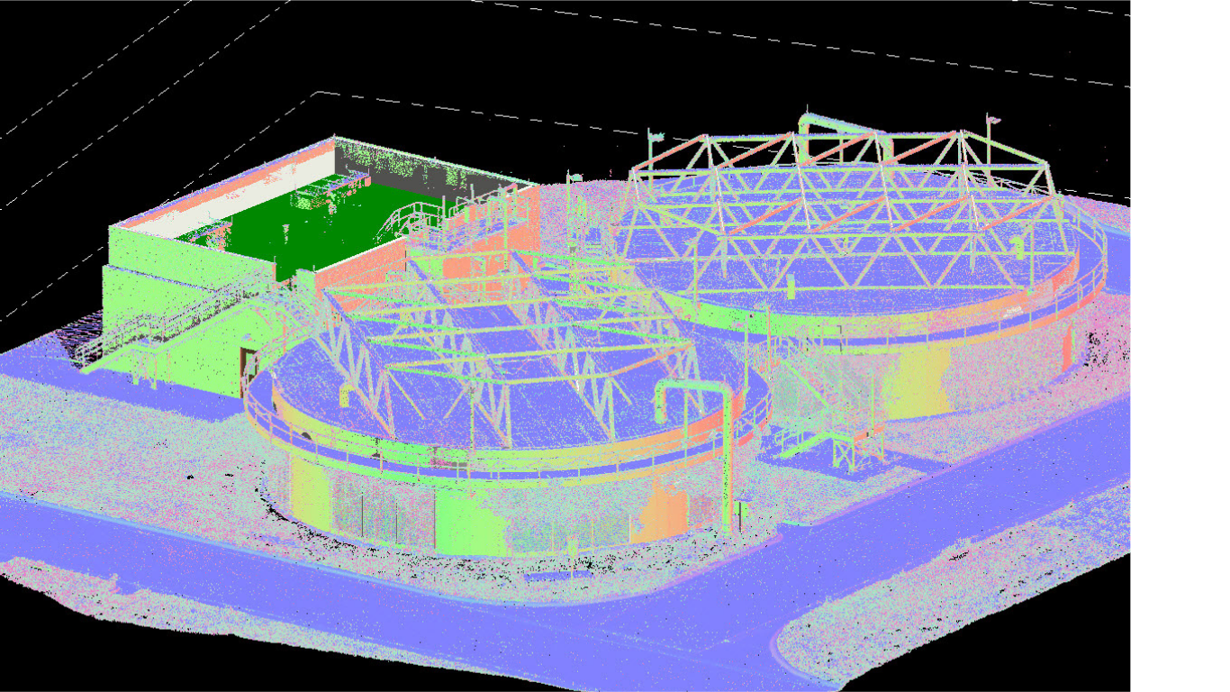
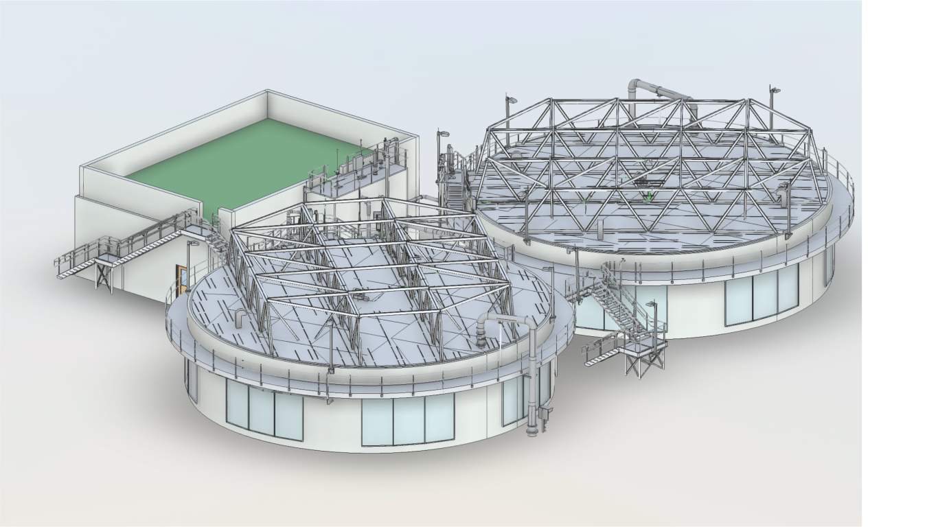
Accurate to the point cloud. Detailed to your need.
Standard output is a clean LOD 200 Revit model traced directly from survey-grade point cloud data — walls, columns, floors, roofs, doors, windows, and primary systems, ready for space planning, renovation design, and test-fits. From there, we zone detail: high where construction drives the build, standard elsewhere.
1" and higher conduits & pipes
Modeled penetrations, routed runs, and support hardware for MEP-heavy retrofits and plant modernizations.
Bolts, plates & connections
Individual connection hardware modeled per member, for retrofits against existing steel and reinforcement work.
Trim, millwork & facade detail
Profiles, mouldings, storefront mullions, and envelope conditions for historic preservation and high-finish work.
Where our models go to work.
Tenant improvements, repositioning packages.
MEP-dense retrofits where downtime isn't negotiable.
Hospitals, imaging suites, patient-occupied phasing.
24/7 environments. Phased and after-hours scanning.
Process piping, equipment relocations, modernizations.
Historic buildings, conversions, salvage documentation.
Hotels, restaurants, flagship retail, storefronts.
K-12 and higher ed renovations, ADA upgrades.
Unit-mix reconfigurations, envelope audits.
Laser scanning, nationwide.
3D laser scanning, scan-to-BIM, and as-built documentation across the United States — single buildings to portfolios spread across metros.
File formats built for every downstream tool.
Autodesk ReCap project file — indexed cloud for direct Revit import.
Open standard defined by ASTM E2807 — works with every scan tool.
Native Revit at specified LOD. Arch, structural, MEP.
ISO 16739 compliant, cross-platform exchange.
Plans, sections, elevations from the model.
Print-ready dimensioned plan sets.
Questions that come up on every scope call.
What is scan to BIM?
Scan to BIM is the workflow of capturing existing building conditions with 3D laser scanners, producing a high-density point cloud, and converting that data into a Revit-ready BIM model. It replaces guesswork and outdated drawings with verified, millimeter-accurate geometry of what actually exists on site.
What level of detail will my model have?
Our standard output is a clean LOD 200 Revit model — walls, columns, floors, roofs, doors, windows, and primary building systems accurately dimensioned from the point cloud. If your project needs more, we scale detail where it matters: modeled MEP runs for trade coordination, structural connections for retrofits, or architectural profiles and millwork for historic and high-finish work. We scope it with you.
How long does a scan-to-BIM project take?
Laser scanning, point cloud registration, and creating 3D models typically take 5 to 10 days for most projects. Complexity in both scope and project add additional time.
What does a project cost?
Pricing depends on square footage, site conditions, target level of detail, and modeled disciplines. We provide quotes against a defined scope with a quick turnaround.
What accuracy can I expect?
Registered point clouds are delivered at ±6mm accuracy onwards, scoped to your project tolerance. The final Revit model is dimensionally verified against the source point cloud.
What file formats do you deliver?
Point clouds in RCP (Reality Capture Project, Autodesk ReCap) and E57 (vendor-neutral open standard, ASTM E2807). BIM models in Revit (.rvt) and IFC. 2D drawings in DWG and PDF. Other formats like NWD, LAS, LAZ, and PTS are available on request.
Do you work on occupied sites?
Yes. We regularly scan occupied offices and healthcare facilities. We offer after-hours and phased scanning to minimize disruption if requested.
Can your models be used for BIM coordination and clash detection?
Yes. Our Revit models are built as coordination-ready geometry. Your coordinator or VDC team can pull them straight into Navisworks or Revit and run clash detection against design models without rework — walls, structure, and MEP are modeled with verified tolerances so the clashes you find are real.
Scanning or documenting a building?
Tell us about your project — send square footage, type of space, location, and scope, and we'll come back with a quote, tolerance targets, and a delivery schedule within 48 hours. No sales call required. And if you have no floor plan — no problem, we laser scan.